a pic a day (day 90)

if you stood overlooking directly to the south from queenstown, a spectacle of extraordinary abundance lies in wait across lake wakatipu. cecil peak at 1,974m (left) and walter peak at 1,815m (right) are named after cecil walter rees, the son of the first settler of queenstown. the breathtaking panorama of the two most noticed peaks (unless if you happen to notice the vignetting first) from the town was photographed in june 2010.

the location:

a pic a day (day 84)

it was silly of me not to include any wide perspective of queenstown and its neighbours in the previous post. taken from the gusty and chilly viewing deck of the skyline gondola restaurant, the resort town is adorned and augmented with the charm of lake wakatipu and the snow covered the remarkables (allegedly named because they are one of only two mountain ranges in the world which run directly north to south). late afternoon, june 2010.

the location:

soul searching road trip oznz – day 9 (14/06/2010)

» soul searching road trip oznz – day 1 (06/06/2010)
» soul searching road trip oznz – day 2 (07/06/2010)
» soul searching road trip oznz – day 3 (08/06/2010)
» soul searching road trip oznz – day 4 (09/06/2010)
» soul searching road trip oznz – day 5 (10/06/2010)
» soul searching road trip oznz – day 6 (11/06/2010)
» soul searching road trip oznz – day 7 (12/06/2010)
» soul searching road trip oznz – day 8 (13/06/2010)


i woke up quite late on the morning of day 9, partly due to tiredness and to the fact that our next destination was only 200 km south. when i opened my eyes, zack was already gone to four square to get our breakfast. ija, aina and the kids were still sleeping so i tiptoed through the bedroom to the toilet for a hot shower.

zack got back with some donuts, pastries and chips. i had a proper breakfast that morning and since it was so comfortable, i decided to checkout as late as possible. after brekky, i walked out to take our laundry and realized that it was mightily quiet inside the block and it was no wonder that zack, ija and aina got creeped out the night before. i took out the dried clothes and brought back to our place for zack to pack. we woke up the kids, ija and aina, forced them to eat at least something and brought the kids outdoor to let them play on the frozen ground. there were still patches of thin snow on the grass that fell on the day before. the temperature was 2°c. the backpackers area was quite large with designated place for caravans and ben ohau range could also be seen from a distance.
▼▼ ben ohau range from high country lodge and backpackers, twizel


▼ our rooms

▼▼ warming up

we left the place at 11:00 am and i drove leisurely next to the scenic ruataniwha lake, and later we passed the town of omarama, all through sweeping views of the southern alps. afterwards, the road (sh8) began to gradually climb uphill and when every corner was covered with gravel and sand (to abate ice and make the road less slippery), i knew we were back in high country. that high country is the lindiss pass.
▼ lindiss pass

when we reached lindiss pass, the snow there was the thickest yet. i had to drive really slow and careful and started looking for a place to pull over. we found the place later, a scenic stop with a stacking slabs sign welcoming us to waitaki district.
▼ getting out

▼ waitaki district sign

this time, they had enough snow to make a mini snowman, snow fighting and in alif’s case, eating more snow. alif and yomi kept insisting on putting snow inside an empty bottle (maybe to drink later) and we let them, again. the views were spectacular with white powdery ground contrasted to the deep blue sky. i stopped for half an hour until they were shivering with cold and we got back inside the car and moved away, going downhill through the otago region. both the kids wailed with frustrations when their snow melted.
▼ spot the kangaroo

▼ sitting close together for body heat

▼ the look on yomi’s face

▼ building a snowman or making an extra large ais kacang

▼ snowfight

▼ making snow angel

later, the road runs parallel to another scenic lake, lake dunstan with pisa range at the back and a rainbow next to it. we left sh8, joined sh6 and we skirted through the town of cromwell while chasing the rainbow and it ended near a citrus grove just behind jones’s fruit stall where i parked again and let the others went inside to buy kiwis, grapes, pears and more tiptop ice creams. it was 1:30 pm.
▼ lake dunstan with pisa range

▼ rainbow near cromwell, otago region

▼ parking at jones’s fruit stall

approximately 30 km before reaching our destination, the road winded through a gorge where mountains surrounded us on each side, pisa range on our right (north) and carrick range on our left (south). the river, next to us, bright green in colour, is kawarau river, and kawarau gorge, with its historical value of being a gold mining site of old was our next stop along the road. however, we only stopped for less than 10 minutes, just strolling through midway of the bridge and we returned back to our car. the place was also the origin of bungee jumping due to its deep gorge and it was sadly not on our itineraries.
▼▼ at kawarau gorge

we left the place soon after and the road settled into flat lands, the ideal place for more vineyards near lower shotover and frankton. next to the town of frankton, the suburbs of queenstown and its famous and mighty lake wakatipu came into view. our hearts leaped into joy of the beauty the town presented to us and i steered the car slowly through mid heavy traffic and found our accommodation for the night at man street. it was 2:30 pm and still a lot of time before the sun set and deco backpackers was right at the end of the street. the road was full of parked cars and i had to wait inside the car while zack went inside to check in. she got back and told me that we could park the car inside the driveway to a house next to it which was also theirs and where our rooms were, but the guy needed to see us first for identification purpose. i felt a bit frustrated of the way he treated us. it was also the only accommodation that i booked without the help of lonely planet’s new zealand travel guidebook. he told us that he wasn’t informed that we would be bringing kids and when i showed him my email that he printed mentioning about the kids, he cooled off and became very friendly and talkative instead and led us to our rooms through the back garden with a view of lake wakatipu.

we brought our bags inside the rooms, one room for me, zack and the kids, another room for aina and ija. there was another occupied third room and all of us would be sharing the same shower and toilet. after taking a breather, i suggested that we just walked to the town centre but not before we tried the panoramic views from the hilltop using the skyline gondola.

walking towards the skyline gondola was quite challenging as it was at the base of the rocky hill, the kids grew tired and we had to take them on our shoulders while walking an uphill road. it was about 300m from deco backpackers. zack queued and bought tickets and i got inside one of them with alif and aina while zack got inside another one with ija and yomi. the gondola rattled slowly up the steep climb and alif and aina got scared a bit but 10 minutes later we reached the top, ben lomond. we waited for zack’s gondola to arrive and walked together to the viewing deck.
▼ on the way to the top

▼ queenstown suburbs and the remarkables

▼ waiting for zack’s gondola

the deck was cold and very windy but provided an excellent landscape of the coronet peak, queenstown, the remarkables, lake wakatipu, cecil peak and walter peak. it was so windy that i had to hold to the metal railings for dear life. we also met a malay family who came from singapore and also self drive through new zealand. it was already late afternoon and we decided 30 minutes later to climb down the gondola and walked to the town itself.
▼▼ from the viewing deck


▼ going down

▼▼ inside the gondola


▼ skyline gondola from brecon st.

walking to the town took us only about 15 minutes and we stopped walking only when we reached the shoreline of lake wakatipu. there were small waves with the resident ducks minding their own business and we just sat on the benches absorbing the views. later we went to the town centre and found ourselves surrounded by souvenir shops, lots of them with signs in japanese and other languages. zack got inside one of them and bought keychains, shirts, magnets, postcards, paua necklace and a sheep plush toy for yomi. next to the shophouses along queestown mall we found a wool shop where zack entered with aina and ija and bought some wools for kak yah, aina’s mother.
▼ zack phooning near lake wakatipu, witnessed by cecil peak (left) and walter peak (right)

▼ alif and yomi near jetty, queenstown bay

▼▼ sunshine bay walk


▼ kiwi wool shop, beach st.

it was almost dark when we found a mcdonald’s outlet inside a shopping mall in beach st. and we let the kids ate fillet o’ fish and some fries. i ordered lamb kebabs from a nearby turkish restaurant and everybody liked it so much that zack went back to the eatery to take away some more kebabs. these were the conversations that took place between zack and the hijab covered kebab lady (with middle east complexion and accent):
► kebab lady: where are you from?
► zack: we’re from malaysia.
► kebab lady: where do you stay?
► zack: at deco backpackers.
► kebab lady: where do you stay?
► zack: what do you mean? here in queenstown or in malaysia?
► kebab lady: i don’t know.

we got back to our rooms when the sun set and everybody ate their fair share of the delicious kebabs and fruits we bought earlier that day. while showering, i could see some boat lights on lake wakatipu from the glass window. the wifi was hopeless but it didn’t mean that i couldn’t sleep that cold night.
next» soul searching road trip oznz – day 10 (15/06/2010)

a pic a day (day 79)

while driving along state highway 8 from lindiss pass towards the town of cromwell in central otago, i spotted this bright rainbow arcing its way across the town and proceeded to chase it until it became a double rainbow and ended near a citrus grove along state highway 6, well past the town. the roy-g-biv continued to shine for more than 10 minutes until it ceased its glow, uplifting my oomph in the process.

the location:

soul searching road trip oznz – day 8 (13/06/2010)

» soul searching road trip oznz – day 1 (06/06/2010)
» soul searching road trip oznz – day 2 (07/06/2010)
» soul searching road trip oznz – day 3 (08/06/2010)
» soul searching road trip oznz – day 4 (09/06/2010)
» soul searching road trip oznz – day 5 (10/06/2010)
» soul searching road trip oznz – day 6 (11/06/2010)
» soul searching road trip oznz – day 7 (12/06/2010)


we left dorset house at 8:30 am after the reception was open. i returned the room key and paid the room charge for the night and also in advance for another day when we got back in 4 days time. the receptionist was really helpful in advising me when i asked her about the mode of transport from the car rental depot to the airport.

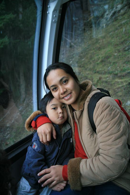
the weather was cloudy with hints of rain and as i drove slowly (50 km/h speed limit) through memorial ave. towards sh1, it began to rain. our car entered sh1 moving towards the south with quite a heavy traffic. we ate what was left of our food while driving although alif threw a tantrum once when we moved passed a burger king and didn’t stop. i drove passed the town of rolleston, crossed rakaia river, the town of ashburton and the rain was getting heavier. just before we crossed the rangitata river, a semi-trailer truck coming from the south came towards our car with snow on the front radiator grill and bar with bits of hardened snow came splashing on our windshield. everybody was mega happy and presumed that it might be snowing up on the southern alps. we were proved wrong as merely seconds later, the heavy rain gradually turned into snow with blizzard like intensity and we were still in the lowlands of canterbury! everybody gasped with surprise and i decelerated slowly and started looking for an opening to pull over. the snow was already quite thick on the ground and i turned right, leaving sh1 into sh79 towards the highland region. i pulled over next to the empty road and everybody except yomi (who was sleeping) and i rushed out of the car to feel and touch their first snow. zack gave me a chuckle when she brought alif out without putting his shoes on and he looked miserable but still enjoying his chips. they were thrilled by the snow-show from the sky and after roughly 5 minutes, they got inside and i resumed my driving.
▼ snowing near ashburton!

▼ alif with his bag of doritos

at geraldine, while filling up the fuel tank, the snowing stopped and the clouds started to give way to a blue sky. the temperature was hovering just above freezing point and when we reached fairlie, enroute sh8, we entered the gateway to mackenzie basin with the grand view of the picturesque new zealand’s southern alps came floating towards us and overwhelmed all our sensory points, and it didn’t stop for the following 4 days.
▼ the clouds are leaving at geraldine

▼ fairlie with albury range

▼ dobson peak, 2,091m on two thumb range

when we ascended the sh8 towards the elevated mountains and cutting through burkes pass between albury (south) and two thumb (north) ranges, we were finally on ourselves on a snowy mountains unlike the previous days where we just looked from afar. i duly stopped at a picnic area and let them played there and i could see the wonders and joys from their faces. they held the snow, threw it, blew it, jumped on it, stomped it, fought with it and in alif’s case, ate it. me? i just held my dslr, pointed at them and the vast panorama that were surrounding them, and released the shutter, countless times.
▼▼ alif and yomi at burkes pass


◄ first snow play ►


◄ blowing and throwing ►


after letting them ran wild on the snow covered field for half an hour, we left burkes pass and descended a bit towards lake tekapo, another awe inspiring vista with its blue lake and white mountains. at 11:30 am, i parked near the church of the good shepherd and we walked slowly on the frozen tarmac towards the famous church and the lake beyond. alif insisted on the brink of crying in bringing a 1.5l bottle water (which was quite heavy) from the car so that he could empty the water into the lake. zack and i found it totally absurd but funny nonetheless of his motive since all our hands were numb from the cold but visualizing the then 3 year old holding a plastic bottle, so we let him. when we strolled past the church, we were presented with a landscape that i could only dream of before.
these were the #1 reason we came here…..the views

▼ lake tekapo with mt. edward, 1,916m

▼ alif emptying the bottle

▼▼ zack at lake tekapo, and with yomi


▼ at church of good shepherd

alif happily poured the water onto the lake’s surface, zack, aina, ija and yomi just sit on the slabs near the shore watching the extraordinary landscape. after sitting and squatting like an eternity, we decided to leave the place and proceeded to our next stop, tekapo town where they went inside a fish & chips shop to take away our lunch. i was left with alif to wander around the small town and managed to capture a fantastic view of the church, the lake and the mountains beyond about 700m away from the back of the shop lot.
▼ alif at tekapo town, last picture of bright’s snowcap before it went missing

▼ wide vista of the lake, the church and two thumb range from tekapo town

we got back inside the car, continued driving slowly while chewing every tiny bit of the scenery through the windy sh8 along snow covered fields, gentle grassy slopes and scattered pine forests until we reached lake pukaki, another one of those godsend spectacular lakescape. the southern shore has a large parking lot with public toilet and information centre at the western end and we parked in the middle facing the lake. as usual it was completely empty and we had our lunch inside the car. when we got out, the chilly winds blew in our faces and aoraki mt. cook, at 3,764m, the tallest mountain in new zealand, was staring directly at us, 60 km away from the north.
▼ having lunch at lake pukaki

▼ aoraki mt. cook from the southern end of lake pukaki

i was stunned by the beauty of it and left speechless by the tranquility of it. after a short visit to the toilet, all i had to do was to follow the only road available to the base of the enormous and famous mountain, sh80, mount cook road.

since day 1 of travel, cruising along sh80 was the most memorable of all, the landscape was truly beautiful, not a degree of the 360° (of any direction) was bad in any way. in front of you to the north, the mighty aoraki mt. cook and its siblings, to your right to the east, lake pukaki and the mountains beyond, on your left (west) lies the serene ben ohau range surrounded by pine forests. on your back (south) is the empty but very cool sh80 that winded its way between the mountain edge and the lake. i stopped numerous times along the way to preserve some memento inside the dslr’s cf flash card.
▼▼ scenic lake pukaki

halfway along the road, we left lake pukaki but the road follows tasman river instead, the river that fed lake pukaki from the melted glacier off mt. cook range. after leaving glentanner village, we were in aoraki mt. cook national park. the view from the road path was magnificent with aoraki mt. cook looked closer and bigger. we also crossed glacial moraine paths and streams from the ben ohau range using single lane bridges many times. the range had already blocked the sunlight from reaching the slopes but burnett mountains on our right (east) were still bright. it was almost 3:10 pm when i exited the road to follow a small path that lead to aoraki mt cook airport. when i parked the car, it was completely empty except us. we crossed the tarmac and walked towards the runway. zack was quite adamant that the climate was tolerable but halfway through, while trembling with cold, she returned to the car to take her jacket and yomi’s. it was 0°c. there were patches of frozen ice and snow on the tarmac. the view of the burnett mountains, with the prominent mt. blackburn, at 2,416m, stood like inches away from us. this was middle earth. it was the location used several times in peter jackson’s lord of the rings trilogy and the location for helm’s deep, the fortress that was defended in the two towers.
▼ walking towards airport runway in freezing condition, and without winter jackets

▼ alif near runway with mt. blackburn, 2,416m

▼ group memento


▼ frozen ground

▼ aoraki mount cook national park

we left the airport soon after that and re entered sh80 towards aoraki. 10 minutes later, the car veered gradually to the left and we entered hooker valley, at the base of mt. cook, fully covered by snow that fell during the morning. i didn’t put the snow chains but drove very slowly to avoid skidding and parked the car at the hermitage, mt. cook village. the village lies between the northern end of ben ohau range and the southern end of mt. cook range with hooker river running through it. they went out and started playing with snow again, the snow was thicker than the one we found at burkes pass that morning. the imposing peak of aoraki mt. cook was majestic but surrounded by clouds. i left them and walked towards the sir edmund hillary alpine centre that lies adjacent to the hermitage but decided against it as the snow was too thick and slippery to walk, it was almost dark as well and i walked back towards the others and took some more photos of them having fun.
▼ more snow at mount cook village

▼ yomi playing snow with bare hands

▼ facing west towards mt. ollivier (1,917m) on ben ohau range

▼ this young hobbit seems lost again

▼ she’s really enjoying it

the freezing temperature didn’t let us stayed outside for long and we decided it was time to go. it was almost 4:15 pm. while driving back, the view of the hooker valley was too much of a temptation and i stopped again next to the road for our final snow of the day. each one of them got out of the car and posed in front of the valley with the imposing mt. wakefield (2,050m) at the back. i believe it was a natural environment at its finest. the lighting from the setting sun was truly amazing and it remained one of my outstanding pictures that came out of the trip.
▼ alif at hooker valley

▼ with mt. wakefield (2,050m)

▼ au revoir!

we said our goodbyes and left the place, damn tired but really fulfilled. i drove the return trip for 1½ hour before we rejoined sh8 and reached the town of twizel where the rest of them went to four square, a supermarket chain. i just stood alone in the almost dark car park, shivering and heating my lungs by puffing the much needed smokes. they got back in half an hour later, bringing a bag of frozen seafood, caulis, broccolis, frozen fish fillets, a tom yam paste, eggs, onions, salt, cooking oil, rice and a 6 dollars hotwheels’ diecast car for alif. i resumed driving and found high country lodge and backpackers just 200m from the supermarket’s car park. while standing at the door, i rang the bell for the reception and the guy who answered said he’d come around in 10 minutes. i waited and when he finally arrived in a pickup truck, he let me in and in a talkative manner, talked to me about the heavy snowstorm that the town received the night before and that morning. no wonder the snow was everywhere. he also advised me to upgrade the room into a bigger family room with an extra 20 dollars to which i agreed. i guessed we truly need the space after what we went through for the past 7 days. he also showed me the wifi area and informed me that we were the only customers that night, as a bonus we could also park our car right in front of our door. i said cheers and proceeded to drive slowly on the frozen grass to our room.

it was more like an apartment, a living room with two bedrooms, 2 single beds in one room, 2 queen beds in another room. it also had a dining table, a kitchen and a sofa bed. zack, ija and aina started preparing our dinner by cooking rice with hot and steamy tom yam, throwing everything in it and it came out delicious and i ate a lot. later, zack and ija went to the coin operated laundry room to wash some of our clothes and came running back scared shitless because of the silence, dark and cold place. the room was in a different block where they had to detour our block first and the corridor inside the block leading to the room was completely dark before they could find the light switch. the temperature that night at twizel was 1°c. ija and aina decided to sleep on the sofa bed in the living room while watching the tv, zack, the kids and i on the other hand slept on one of the queen beds. overall, i drove 400 km during that particularly interesting day.
next» soul searching road trip oznz – day 9 (14/06/2010)

a pic a day (day 68)

layers of different tones created an amazing backdrop along state highway 80, mt. cook road which runs parallel to lake pukaki, one of the many jaw-dropping alpine lakes on the mackenzie basin. the terrain, with the distinctive blue colour of the lake is created by glacial flour and fed by the tasman river, nicely complemented by the beige colour of the dry winter grass and the green pines, walled by the distant snow powdered two thumb range and the blue sky, was the closest thing to a heaven on earth my sane eyes and mind could accede. june 2010.

the location:

soul searching road trip oznz – day 7 (12/06/2010)

» soul searching road trip oznz – day 1 (06/06/2010)
» soul searching road trip oznz – day 2 (07/06/2010)
» soul searching road trip oznz – day 3 (08/06/2010)
» soul searching road trip oznz – day 4 (09/06/2010)
» soul searching road trip oznz – day 5 (10/06/2010)
» soul searching road trip oznz – day 6 (11/06/2010)


i woke up at 5:45 am, together with zack, woke up the rests and by 6:45 am, we checked out and later, pulling our bags, walked across the intersection into bluebridge ferry terminal. why did i choose bluebridge over interislander ferries when most visitors and tour packages prefer interislander? well, the main reasons were that the terminal is only a short walking distance (50m) from wellington downtown backpackers. the ticket prices are generally cheaper and bluebridge is also the pride of new zealanders while interislander is owned by foreigners (or so i’ve heard).

it was still dark when we entered the terminal building but check in time was at 7:00 am and we planned on taking the easy approach without rushing. the departure and arrival would be from 8:00 am to 11:18 am at picton. we checked in our bags and sat on the benches waiting along with other passengers. by 8:15 am, an announcement was made that monte stella’s departure would be postponed until 9:30 am as there was some mechanical problem with the engine. zack, ija and aina were giggling at the handsome bluebridge counter staff who got confused with his grammar while writing the delay notice on the white board. we were still fine with it and went outside for some photos. it was a windy and cold morning. i befriended a large fellow smoker of indian muslim origin from fiji who told me that bluebridge is known to change their schedules regularly. he was on his way to visit his sister at blenheim on the south island and went on a rant about the lack of halal meat especially in blenheim and generally in the south. the day before, he got stuck almost a day on the overlander train journey from auckland (where he lives) to wellington when the locomotive broke down and needed a replacement. he also advised me not to accelerate more than 106 km/h while driving on the state highway.
▼ dusk at wellington harbour with monte stella

▼ bluebridge’s santa regina

▼ wellington downtown backpackers in light green, taken from bluebridge terminal

▼ the beehive at centre

at 10:00 am, the handsome employee announced that a feeder bus would be coming to fetch us to interislander ferry instead. we were delighted at the news before he received a phone call and told us that our very own ailing monte stella was actually getting better and finally decided to chauffeur us across the strait. 20 minutes later the door behind the terminal was opened and we walked 100m along the harbour to the docking bay where monte stella’s stern was opening up to swallow us. we stepped on the apron ramp into the vehicle deck, climbed up two flight of narrow stairs and entered the passenger deck.

the seats were comfortable with enough leg room with a large screen showing the imaginarium of doctor parnassus. later we realized that there’s a door behind us that led to the outer viewing deck! everybody scrambled through the door to a spectacular view of wellington city. all of us sat on the wooden benches and at 10:30 am, monte stella began moving away from the harbour gently with intermittent loud grunts. it was windy and cold, but it was also sunny and the view was marvelously lighted into every detail. it was a slow ride but we loved every minute of it. we were leaving wellington bay and entering the cook strait. we also explored any deck that could be accessed by passengers, the side open deck and the stern deck. on the hilly end of the north island, we could also see the swirling blades of a wind farm, and when we left the rock formations of breaker bay, we left the harbour for good and into the deep blue cook strait.
▼▼ leaving wellington city


▼ nice weather

▼▼ leaving the harbour


▼▼ alif on the side deck


▼▼ zack and yomi


▼ leaving north island

we spent most of our 3 hours 100 km trip on the ferry sitting on different benches on the open deck and regularly glancing towards the south hoping to glimpse the coastline of the south island. the cold winter wind was blowing hard against me but hardly undeterred as i began to see an outline of snow capped mountains miles away and i ran towards the others inside the cabin deck to tell them. they came outside and gleefully watching the mountains getting nearer. later we approached the south island through marlborough sounds, covering extensive networks of sounds, islands and peninsulas. the sea was dark green and it was a sight to behold. the ferry captain gave an announcement that the ferry was approaching picton and dark clouds began to engulf the sounds with a light rain and all of us returned to our seats inside the passenger deck. 30 minutes later, the ship successfully docked at 1:30 pm and we began descending the stairs carefully towards the vehicle deck and out through the stern of monte stella onto picton harbour.
▼ snowcapped mountains!

▼ entering marlborough sounds

▼▼ watching the views with both kids sleeping


▼▼ arapawa island

during that time, the clouds were again clearing and a feeder bus was idly waiting to send us to picton bluebridge terminal about 1 km away. when the bus dropped all the passengers at the terminal, we rummaged through all the checked baggages and found ours. i called ace rentals to inform that we had arrived at the terminal and the staff said that she would be coming to fetch us in 30 minutes. we waited at the terminal with alif and yomi playing at a wet playground next to the building. then i called dorset house to inform them that we would be arriving late since the ferry got delayed. i also tried to walk towards our rental car office lot but decided to return after 300m of walking because it was too far away, about 1.5 km from us. the rental company is located next to interislander terminal, near picton town while bluebridge terminal is further north near the railway terminus.

20 minutes later, a roughly 5 year old white toyota estima (my guess) arrived and the driver, susan from ace rentals came out, she introduced herself and apologized for being late. we got in the car and she drove back to the office and i went inside the office with her to fill up some forms. i decided to take the more expensive insurance that included windshield protection as our trip would be longer than the previous trips. i also had to rent snow chains as required by the law to drive in mountainous roads during winter. she was very friendly and gave me an on hand instruction on how to apply snow chains by squatting next to the car. we shook hands, i got in the car while susan locked the office door and began walking towards the town. inside the car, getting the feel of a new (old) car was one thing, but missing the hand break lever was another thing! as i could not locate the lever, i got out of the car and hollered at susan who was 40m away to come back and helped us. when i told her that i could not find the hand break, she laughed and said that the same thing happened to many drivers before and pointed to a pedal further left to the accelerator pedal. so it was not a hand break anymore! we thanked her and left the parking area, moved slowly passed picton town and drove through sh1 again southbound. it was 2:15 pm.

the delay of the ferry led me to speed things up a little bit, a quick stop for a toilet break on the outskirt of picton near the airport. another long stop at the town of blenheim’s new world for food supplies and mcdonald’s take away. and we drove along dry horticultural farmland with vast vineyard areas and when i drove passed seddon, the snow capped mountains we saw earlier on the ferry came into view. it is the kaikoura mountain ranges and our second snowy mountains after mt. ruapehu. our spirit lifted and the highway descended to the shoreline of the eastern side of the island facing the south pacific. the sh1 runs alongside the tranzcoastal railway line from picton to christchurch and the mountain and sea views were amazing. we stopped near the ohau point lookout and saw a colony of seals on the rock formation below us. later i stopped for a short cigarette break and it was almost dark but the quiet moment, with cattles grazing near the highway gave me a feeling that could not be described with words.
▼ quick stop near picton airport

▼ with companion #3

▼ alif without shoes!

▼ blenheim’s new world

▼ near seddon for an early glimpse of the mountains

▼ kaikoura mountains

▼▼ pulling over near ohau point lookout


▼ state highway 1 alongside tranzcoastal rail track

▼ watching the seals

▼ the seals

▼ zooming

we entered kaikoura in semi darkness and did not stop as our journey was far from over. later, all the passengers were dozing off and i was left alone to navigate the road. it felt a lot like night driving to my hometown in kelantan except that time it was really cold. alif shared the same feeling when he asked me repeatedly whether we were on our way home to kelantan and demanded the where about of his grandparents’ house. we took a toilet break at chevron but the freezing wind did not let us stay long before we continued towards christchurch.

when we entered the outskirts of christchurch, i mistook a signpost and turned into harewood st. where i stopped to look at a map, but then ija realized that next to our car was a cemetery and everybody got scared and urged me to leave the place. i had to u-turn and rejoined sh1 and finally found the road that would led directly to the city centre, memorial ave. after 345 km of driving, we arrived on the doorstep of dorset house at 8:00 pm and parked our car at the parking compound at the back of the two storey house. the reception area was already vacant but they left our door key inside an envelope pasted on the main door. our room was on the 2nd floor, with a queen size bed and two singles but no bathroom, so we had to share with the others. i took a bath, zack and ija went to the kitchen area to prepare dinner and later brought our bread with tuna sandwiches back to the room. it was delicious.
next» soul searching road trip oznz – day 8 (13/06/2010)

soul searching road trip oznz – day 6 (11/06/2010)

» soul searching road trip oznz – day 1 (06/06/2010)
» soul searching road trip oznz – day 2 (07/06/2010)
» soul searching road trip oznz – day 3 (08/06/2010)
» soul searching road trip oznz – day 4 (09/06/2010)
» soul searching road trip oznz – day 5 (10/06/2010)


we started the day by going to the fuel station next to tiki lodge to fill up the tank. we left taupo at 8:30 am and the road took us along the windy shore of lake taupo. the weather didn’t look good, it was bleak with dark clouds hovering all around us. i stopped once at frethey drive scenic stop for photo opportunities just before we left the lake for good towards the south.
▼ tuwharetoa st., taupo from tiki lodge

▼ gloomy lake taupo from frethey dr.

when i drove through the town of turangi, it rained heavily and i had to use a cloth to wipe the windshield fog before zack discovered the heater button for the windshield. once activated, i was more comfortable driving but the climate was getting colder. about 10 minutes later, we entered tongariro national park through sh1, where the road ascends to the north island volcanic plateau and passing through rangipo desert, commonly known as the desert road because of its harsh, alpine climate, poor soil quality with minimal vegetation. heavy snowfalls are also a common occurrence. luckily it did not happen that day. but unluckily, the clouds were so thick that mt. ngauruhoe totally evaded and shied away from us. i kept turning my head to the right in hoping to glimpse the scenic mountain (which had taken the role of the fiery mount doom in the lord of the rings trilogy), but had to admit defeat after we were well beyond the mountain by the appearance of another famous mountain.

the sighting of the foot of the other mountain (the top was still shrouded by clouds) brought our hearts racing as we were seeing mt. ruapehu, an active volcano and also the highest mountain in north island. interestingly enough, we also started seeing white patches of snow on the ground! everybody was gushing with excitement at seeing the snow and opened our car windows to feel how cold it might be. it was indeed freezing and we literally ooh’ed and aah’ed at the views while the cloud slowly shifted around the mountain.

we pulled into a scenic stop with an open view of the mountain and all of us clambered out of the car to a wooden fence near the edge of a drop. aina and ija went cheerfully about 50m from the car to cup and hold a day or two old frozen snow. although the clouds never left the peak, at least it began to thin slightly and i could see some semblance of a peak. we took turn posing for photos with or without our winter jackets (just to show how tough we were) and the kids didn’t seem to mind the frozen temperature. the only downside to the view was the crossing of overhead transmission lines that were clearly visible in the foreground in contrast to the exceptional backdrop.
▼ mt. ruapehu

▼ freezing!

▼ testing body limit against the cold

▼ having his biscuits

▼ yomi getting sheepish

with freezing temperature and wind chill blowing against us, we got inside our heated car and drove another 10 km before reaching the military town of waiouru. we parked at the army museum and visited the military heritage such as tanks and canons that were exhibited on the compound. 15 minutes later we looked at mt. ruapehu for one last time, then it was time to move further south.
▼ aina and alif at the army museum

▼ with a tank

▼ yomi with gossip cat

▼ waiouru town with mt. ruapehu

half an hour later, at 11:30 am we arrived at taihape, a small town of 2,000 urban population and parked along the main street (still sh1) in front of new world, a local supermarket chain. zack and ija went inside and bought donuts, huggies for the the kids (they were still wearing those at the time) and 5 dollars 2 degrees sim card with 20 dollars worth of talktime. we left the place and parked at mcdonald’s further down the road and had our lunch of the usual stuffs. i setup the phone, dialed bargain rentals car 2000 and informed them that i would be returning the car by 4:00 pm that afternoon. we still got 230 km to get to our final destination of the day. and hopefully before night time.

the rest of the long trip was spent on entering and leaving small towns along sh1 and marveling at the countryside. i drove passed hunterville, bulls, (stopped for a quick smoke), foxton, levin and near otaki, the sky was getting bluer and between paekakariki and pukerua bay, the highway veered next to the cliffs along the tasman sea with high rolling waves hitting the boulders and everybody was excited again. the road was so narrow with heavy traffic that there’s no chance of stopping by.

the road winded inland and crossed porirua harbour and i misread a signboard and exited the motorway into porirua town where we had to detour and subsequently got stuck in a school area but managed to get back on the motorway. i was a bit anxious as the fuel was almost empty but soon completely forgotten as we moved pass the hilly range and wellington harbour came and greeted us instead! the view of the narrow smallish city, its surrounding hills and its harbour that day were astounding. we moved along the three lane motorway slowly and nearing the city, i steered the car off the motorway into waterloo quay that ran adjacent to the harbour. i kept reminding the others to look for interislander ferry terminal on the left and once located, our quick stop to drop zack and others was only a small distance away further down the road. when we reached the wellington railway station on the right, i gave a turn signal to the left and entered bluebridge ferry terminal carpark on the left. i knew from reading google maps that there would be ample free parking lots at the terminal since the ferries only leave wellington twice daily and at 3:15 pm, the last ferry of the day had already departed.

zack, ija, alif and yomi got out of the car with the bags and i instructed them to cross the road at the intersection and from the lot, we could see wellington downtown backpackers (previously known as waterloo hotel) just 50m across from the railway station. i got back inside the car with aina and continued to drive towards the south, turning right into taranaki st. and found a fuel station to fill up the tank. after that, i drove for about 500m before turning into abel smith st. and entered the compound of bargain rental cars at 3:30 pm. they welcomed us and inspected the car and called a taxi for us. companion #2 and i parted ways after 1,010 km together on the road. we took the taxi back to wellington downtown backpackers to rejoin zack and gang who were waiting for us at the lobby. they had already checked in and led aina and i to our rooms, 2 adjointed rooms consisted of 2 tier bunk bed each with a shared bathroom.
▼ parting ways with companion #2

we left our rooms later and rushed through the busiest and trendiest street in wellington, lambton quay, looking for the terminal to kelburn cable car. after spending some time looking for it, we gave up and asked a passerby who duly showed us the hidden entrance and we took our first cable car of the trip up the hill towards wellington botanic garden. the view of wellington city from the hill was stunning and we lingered there until sunset. my original plan was to walk back to the city centre using the downhill path but since it was almost dark and the kids looked tired, we decided to take the cable car ride again downhill to lambton quay. we window shopped with the kids on our shoulders again and later ate our dinner at another mcdonald’s and bought some take away sandwiches at a subway outlet where we feasted in our rooms.
▼ wellington cable car

▼ wellington botanic garden

▼▼ at the top of the hill with views of wellington


▼ wellington city and harbour at dusk

▼ inside the cable car on the return trip

later, after a hot bath, i made a solo walk to the railway station and took some photos, decided against walking through the darkness to the beehive (the parliament building) about 300m away since it was already late and the temperature was freaking cold (4°c). i went back to the backpackers café to use wifi instead. ija and aina shared one room while zack, alif and yomi occupied the lower bunk and i on the top bunk of the other room. we all slept soundly that night.
▼ wellington railway station

next» soul searching road trip oznz – day 7 (12/06/2010)